A Layer Feature is an individual location within a layer, such as a single fire hydrant. This guide covers how a Tango Tango Admin can add Features manually, one at a time.
Have a lot of locations to add?
If you already have a file with all your hydrant locations (such as a Shapefile or CSV), follow our Bulk Import guide to upload them yourself, or email support@tangotango.net and we'll help you with the upload.
Adding a Feature manually
Go to manage.tangotango.io and log in.
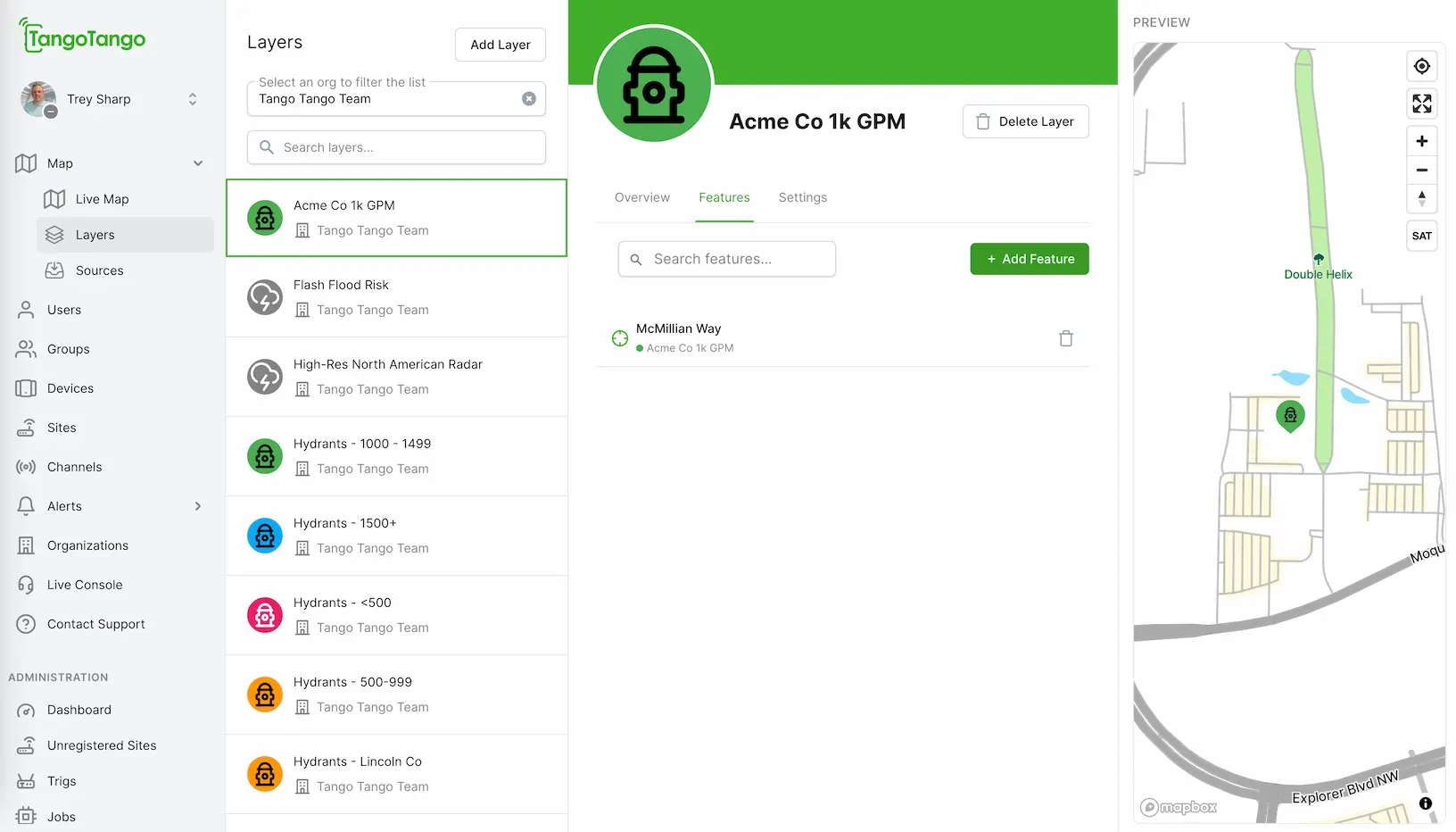
Click Map, then Layers.
Select the layer you want to add a Feature to.
Click Features, then Add Feature.
Under Create Feature, enter:
Name (required)
Latitude and Longitude (required) - only decimal degrees accepted, convert minutes or seconds before adding. Note: in the USA, west longitudes are a negative number.
Description (optional)
Click Save Feature.
Your Feature is now live for everyone in your organization.
Don't know the latitude and longitude?
You have two options:
Use the map: Drag the pin in the preview map on the right to the exact spot. Latitude and longitude fill in automatically.
Look up an address: Enter the address into a geocoding tool (search "address to latitude longitude") to convert it to coordinates, then paste them in.
Made a mistake or want a Feature to go away?
Deleting a Feature
Go to manage.tangotango.io and log in.
Click Live Map, then Layers.
Select the layer you want to delete the Feature from and click "Features".
Either use the search box to filter the list of Features or simply scroll down the list of Features to find the Feature you want to delete. Click the trash can to the right of the Feature to delete.
Click "Confirm" to finish deletion. Deleted Features are removed for everyone in your organization immediately.
Still stuck?
Reach our support team — Mon–Fri, 8am–5pm Central.
.webp)